 Lorraine Williamson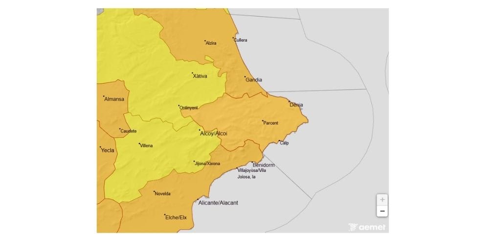
Residents and visitors along parts of Spain’s eastern coast are being urged to take extra care overnight and on Thursday morning, with AEMET warning that exceptionally heavy rain could deliver more than 120 litres per square metre in just two or three hours in some areas.
The strongest warnings affect the Alicante coast and southern Valencia coast, where orange-level alerts for heavy rain come into force during the early hours of Thursday 17 September. AEMET forecasts up to 60mm in one hour and 120mm over 12 hours, with even higher totals potentially concentrated into a much shorter period.
Alicante prepares for heavy rain
The orange warning covers both the northern and southern coastal areas of Alicante province, with the most significant rainfall expected during Thursday morning. Thunderstorms are also forecast and could bring hail.
The timing is important. The highest-level warnings begin during the night and continue through much of the morning, meaning conditions could already be difficult when people wake up or begin travelling to work and school.
Authorities are therefore taking precautions before the rain arrives. Alicante city has announced that its municipal parks will remain closed on Thursday, while emergency services including Policía Local, firefighters and Protección Civil are being placed on preventative standby.
Schools close in parts of Alicante province
Some municipalities are going considerably further.
Elche, Santa Pola and Crevillent have suspended classes for Thursday morning, with the measures currently expected to remain in place until 3.00 pm. Parks and other outdoor facilities are also being closed, while sporting and recreational activities have been suspended in affected municipalities.
In Elche, the decision followed the declaration of the orange alert for rain and storms along Alicante’s southern coast. Residents have been asked to avoid unnecessary journeys and pay attention to official information as conditions develop overnight.
Southern Valencia also under orange warning
The threat is not confined to Alicante. Southern coastal areas of Valencia province are also under orange warnings for intense rainfall, with similar totals possible during Thursday.
Elsewhere in the Valencian Community, yellow warnings remain in place for rain and thunderstorms. Storms could also produce hail, adding another potential hazard for drivers and anyone outdoors.
The Generalitat’s Emergency Coordination Centre is monitoring conditions across the region, while municipalities are introducing their own preventative measures according to local risk.
A preventative release of water has also been announced at the Buseo reservoir because of the expected rainfall. Municipalities downstream have been advised so that potentially affected areas close to the river can be monitored and access to vulnerable crossings restricted if necessary.
Valencia wildfire burns 880 hectares as storms threaten firefighting effort
What should you do if you are travelling on Thursday?
The orange warning does not mean every location will receive 120mm of rain. Thunderstorms of this type can be highly localised, leaving one area with relatively little rain while another nearby receives an intense downpour.
That unpredictability is one reason short journeys can become hazardous very quickly. Roads, underpasses, ramblas and other low-lying areas can accumulate water rapidly during torrential rainfall.
Anyone travelling through Alicante or southern Valencia on Thursday morning should check the latest AEMET warnings and local authority information before setting out. Never attempt to drive or walk through a flooded road, rambla or watercourse, even if the water appears shallow.
A difficult night and morning ahead
The most important period begins during the early hours of Thursday and continues through the morning. Conditions should gradually improve later in the day, although warnings remain in force in several areas into the afternoon.
For residents in the affected coastal areas, this is therefore one weather warning worth checking before going to bed tonight and again before leaving home on Thursday morning.
The forecast will continue to be updated as the storms develop, and local emergency measures may change at short notice.