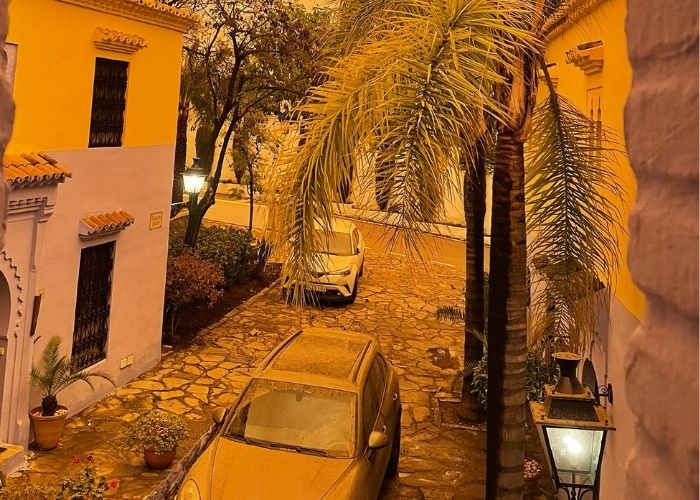
MADRID – Anyone who started a major clean-up after the second episode of Sahara desert dust mixed with rain will be disappointed. The third Calima is on its way to the south and southeast of Spain.
As a result of strong winds, the Sahara sand is lifted and then blown northwards via the higher air layers. There it comes down again with a new rain front in the form of mud. That writes @storm_malaga on Twitter. MundoDeportivo.com also picks up the news and Diario Sur relies on forecasts from the Spanish weather institute AEMET.
AEMET does not rule out the rain in the form of mud for late Monday 28 and Tuesday 29. Therefore, that means more bad news. Just this weekend, in between two rain fronts, major cleaning of cars, terraces, and facades have started.
Last Thursday’s second Calima was even more violent in southern and southeast Spain than the first one a week ago. Rain fell from the sky like drops of mud and covered everything with a thin layer of terracotta-coloured clay.
Bad weather
Specifically for Monday, Aemet is forecasting “overcast or partly cloudy skies. It does not rule out the occasional shower in the western third of Andalucia and around the Strait of Gibraltar. Showers will move west in the afternoon and towards the end of the day they also arrive in the south of the Andalucia region, from then on the rain can be accompanied by mud deposits.
Also for Tuesday, “widespread showers, accompanied by mud deposits and, occasionally, storms” are expected along with a possible Calima.
Calima less intense
According to the forecast of the meteorological models, the mass of air with dust particles and sand from the Sahara will not be as intense as that of more than a week ago and last Thursday.
Weather Alerts
AEMET will be holding a yellow weather alert from 10.00 pm Sunday to 8.00 pm Monday due to high winds and high waves (up to three metres high).
Other parts of Andalucia will also receive a weather warning on Sunday and Monday. Orange applies to the Strait of Gibraltar from Monday 12 noon to 8.00 pm due to high waves. At 1.00 am in the morning code orange (major risk) is activated on the Atlantic coast of Cádiz and at 8.00 pm on the west coast of Almería and the Costa Tropical of Granada.
Similarly, for the province of Cádiz, strong gusts of wind in the Gibraltar zone are in place from 10 a.m. and on the Atlantic coast and in the countryside from 6.00 pm until the end of the day.
Deteriorated air quality
The arrival of this new mass of African dust will worsen air quality in all areas it passes through, so it is recommended that you wear a mask when going outside.
Also read: Second calima in a short time


