
Spain is a hiker’s paradise. That may surprise many. After all, Spain is ‘the land of sun, sea, beach, tapas, and flamenco’ with a Parador hotel or historical monument here and there. However, many areas are literally dotted with hiking trails. Most have been set out by government agencies directing nature lovers to unique sites, springs, ravines, ruins, natural monuments, panoramas, and rivers.
Pilgrimage routes and European hiking trails
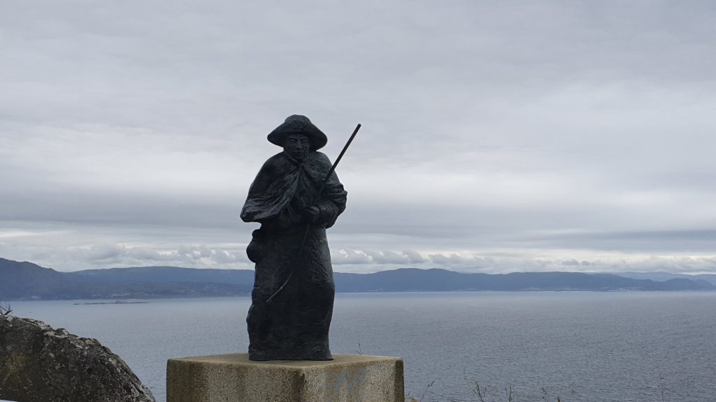
The routes naturally vary in length. Some trails can be completed within the hour, but real diehards can also choose routes that provide a few days or even weeks of hiking pleasure. World-famous in the north of Spain, for example, is the pilgrimage route to Santiago de Compostela, which can be followed not only from France but also via connecting pilgrim paths from Seville and Alicante and even Portugal.
Gran Recorrido and Pequeño Recorrido
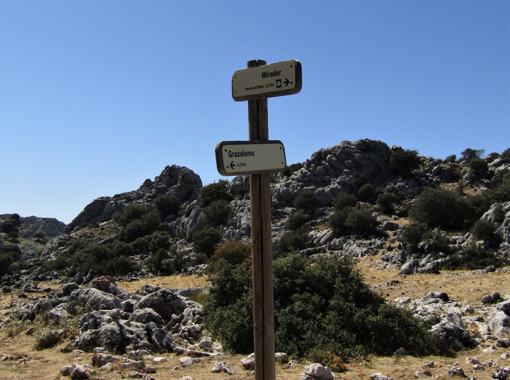
The European hiking trail E-4 runs right through Spain where it is indicated as GR-7. GR stands for Gran Recorrido (Grand Tour), in contrast to the countless “PR walks”. PR stands for Pequeño Recorrido (Small Tour). The GR routes are marked with red and white markings and the PR routes with yellow and white markings. The E-4 starts – or ends – at the temple of Delfos in Peloponesus, Greece, and runs through Bulgaria, Serbia, Croatia, Slovenia, Italy, France, and Andorra. It enters Spain in Catalonia. Furthermore, it goes along the entire Spanish east coast via Andalusia to Gibraltar. There are several connections with other GR-routes along the way. And not fully set out yet is the GR-92, the Sendero del Mediterraneo. This follows the coast from Port-Bou in the north to Tarifa in the south.
GR routes in Valencia and Andalusia
In the Comunidad Valenciana, the hiking tours of the PR are indicated with PR-V; they all have a number. Futhermore, there are over than two hundred routes in total, with more than half located in the province of Alicante. But they are mainly concentrated in the regions of Marina Alta and Marina Baixa and the region between Alcoy and Elda. This makes sense as this is where the most extensive mountain ranges can be found.
In Andalusia, most PR routes (marked PR-A) run through the provinces of Jaén and Málaga. There are 175 in total. Most of the routes in Jaén are located in the Sierra de Cazorla, Segura y las Villas nature reserve. There are 18 PR-routes to follow on the Costa del Sol in the province of Málaga.
Donkey paths
Plotting these PR tours requires a lot of effort. An original “camino de herradura”, a donkey path, is often used as a guide. But these paths were already built by the Moors along the mountain flanks or river banks. They were often paved with boulders and steeper pieces were carved in steps. They led to other villages or to agricultural fields. In the Middle Ages, they formed a vast network of connections ridden with donkeys. Many donkey trails are well preserved, others have been destroyed by erosion or construction. Nowadays, municipalities are reopening these paths. So they connect them with country roads or ordinary hiking trails so that more and more beautiful tours can be mapped out.
Maintenance
Most hikers are familiar with the yellow-white markings, as they pop up everywhere. A coloured brochure is issued for each PR tour. But most municipalities also ensure that the markings are renewed where necessary and that the paths do not get overgrown. Maintenance is essential to keep hikers “on the right track”. Getting lost can be dangerous, especially in the many mountain areas in Spain.
Vias Verdes on old railway lines
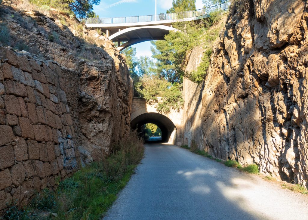
In Spain, there are more than 7,000 kilometres of disused railway lines. The general management of the Spanish Railways has opened this infrastructure – including bridges, stations, and tunnels – for the construction of walking or cycling paths. This has resulted in over 3.000 kilometres of Vias Verdes. Provinces, Juntas, hiking, and cycling organisations working closely together. There is a distinction between arranged and non-arranged routes. Along the arranged routes, old station buildings have been transformed into rustic hotels where you can also eat and drink. It is therefore wise to carry food and drink for the routes that are non-arranged. The Vias Verdes are also indicated by yellow signs with the logo of the organisation.

Valencia green routes
On the Costa Blanca, one runs from Alcoy to La Canal, with a length of twelve kilometres over three viaducts and eleven tunnels. From Agost to the Maigmo, a distance of 22 kilometres is covered over two viaducts and six tunnels. A green route of seven kilometres has been set out from Torrevieja to Las Moreras. The longest Via Verde runs from Villena to Alcoy; the 72 kilometres can also be covered by bicycle. Interesting places such as Biar, Bocairent, and Agres are passed and the Sierra de Mariola is crossed. And not to be missed is the 51-kilometre route between Totana and Cartagena in the province of Murcia, through the Sierra Espuña and the 40 kilometres between Muro de Alcoy and Gandía, through the famous gorge of the Serpis.
Some municipalities in Valencia have taken initiatives themselves and supplemented the existing PR-V tours with the so-called senda verde (the green path). The same markings of the GR or PR are used but in green and white. These are often extensions of the existing PR-V, which guide the walker to a historic building or panoramic view via a loop.
Andalusia green routes
In Andalusia, there are greenways through the Sierra Nevada, Sierra Subbética, along the banks of the Huéznar, from the Roman city of Itálica, over the old railway line at the mines of Río Tinto and along the olive oil route in the province of Córdoba.
Roman times revived
The Via Augusta is the longest Roman road on the Iberian Peninsula. But what is special is that the authorities want to turn it into a cycling and walking route. This new tourist route naturally draws attention to the historical and cultural aspects of “the old” road “. The Romans took advantage of existing Iberian paths and roads to build their cobbled roads so that their armies could move quickly through the empire.
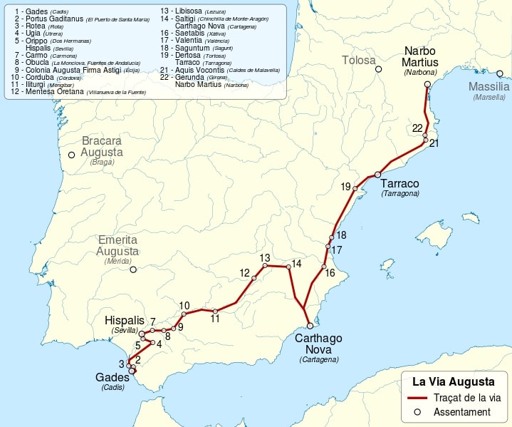
At 1500 kilometres, the Via Augusta is the longest Roman road in the entire Iberian peninsula. It runs from the Pyrenees to Cádiz. In the Comunidad Valenciana the route has a length of 425 kilometres. And in total there are 96 monuments along the road. Here and there, short pieces of the original paving stones have been preserved. Furthermore, you can see the remains of Roman villas, bridges, settlements, triumphal arches. Over the centuries this important road has been given many names such as the Vía Hercúlea, Camino de Anibal, and Ruta del Esparto. But the original name refers to the emperor Augustus who built it.
Silver Route
The silver Route (Ruta de la Plata) connects the north with the south of Spain. From Seville, the silver that was mined in the mines in the area that is now Andalusia was transported to Gijón in the far north.
Theme routes
Governments everywhere want to attract tourists to their regions with special routes. Already, many theme routes have been created. But it is unclear how many rutas del vino (wine routes) or rutas del aceite (olive oil routes) lead through Spain. The region of La Axarquía in the province of Málaga, devised a wine route, olive oil route, raisin route, and even a mudéjar route. This guides tourists and day-trippers to visit the highlights of the region. The Washington Irving route also runs through Andalusia through the famous Alhambra in Granada. Castilla-La Mancha is dotted with routes of Don Quixote. The Camino del Cid takes the walker through the Spanish Middle Ages in the footsteps of the Spanish knight Rodrigo Díaz de Vivar, nicknamed El Cid.