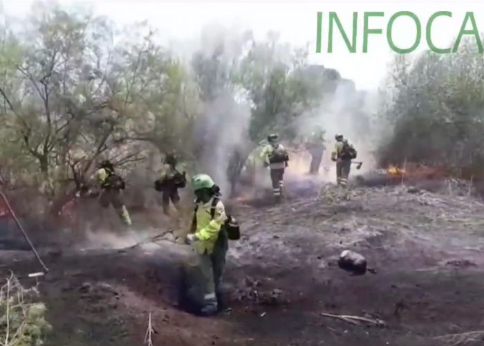
MADRID – The drought in the spring and the high temperatures during the heatwaves of June and July have contributed to the fact that thousands of hectares are now blackened and burned in provinces such as Zamora, Salamanca, Cáceres, Lugo and Ourense.
More than 220,000 hectares of land have been burned, and destroyed by fire in Spain so far this year. That is more than in 2012, the worst year to date. A new map of Spain shows exactly which areas are involved. The information for the map was provided by the Copernicus program of the European Commission and shows in detail the areas burned between June 12 and July 26.
The European Commission’s Copernicus program has mapped many of the areas affected by forest fires using the MODIS sensor onboard the TERRA and AQUA satellites. These provide daily aerial images of burned areas with a spatial resolution of 250 meters. The website Ecoavant designed a map based on this data.
Click here for the map.
Castile and León
During the early heat wave in June, one of the largest fires in Spain’s history occurred in the Sierra de la Culebra (Zamora). More than 25,000 hectares were lost here in 11 days, according to data from Copernicus and the regional government. Then at least 30,000 hectares burned down in the fire in Losacio, also in Zamora. This is also the largest forest fire in Spain in the past 20 years.
This year, 39,541 hectares more have been burned than the average for the past ten years. This is according to data from the Ministry of Ecological Transition.
Another major fire in the region was the one in Monsagro (Salamanca). Coinciding with the second heat wave in July, it destroyed 8,623 hectares around Las Hurdes (Cáceres).
In Extremadura, the fire that started near the town of Casas de Miravete affected 398.26 people in the Monfragüe National Park, according to estimates by the management of this protected area.
Galicia
The wave of fires that have hit Galicia since mid-July has destroyed some 30,000 hectares. That figure is close to that of the Sierra de la Culebra. The two main fires, at O Courel (Lugo) and Valdeorras (Ourense), have recorded historical figures of over 10,000 hectares each.
Other fires such as those in the Sierra de Mijas (Málaga), Artesa del Segre (Lérida), those in the vicinity of Valdizarbe and El Perdón (Navarra) or Almonte (Huelva), among others, have also affected thousands of hectares of natural environment.
In the Canary Islands, the island of Tenerife was hit. In the north, an area of 226 hectares in Teide Natural Park burned.
95% of forest fires are caused by humans
According to the Spanish authorities, 95% of forest fires are caused by humans, mostly through negligence, sometimes started. For this reason, the Directorate-General for Civil Protection and Emergencies of the Ministry of the Interior is calling on the population to exercise extreme caution in the hottest months and to take preventive measures.


